
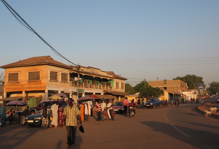
The Republic of Ghana is one of the countries in the Western part of Africa. It has a population of over 31 million people which accounts for her being the second-most populous country in West Africa. She shares common boundaries with Togo, Ivory Coast, Burkina Faso, Gulf of Guinea, and the Atlantic Ocean in the east, west, north, and south respectively.
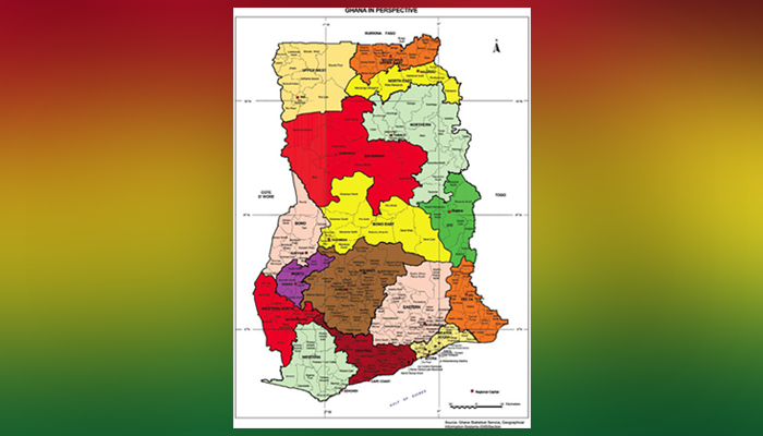
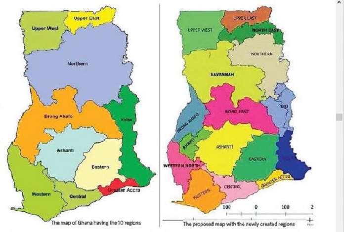
Ghana covers an area of 238,535 km² (92,099 sq/m) which consists of various regions. As of independence in 1959, Ghana had only 5 regions but about 2 decades later, 10 regions were created. Currently, with the referendum on the creation of six new regions which was held on the 27th of December 2018, Ghana has 16 regions.
Here Are The 16 Regions of Ghana & Their Capitals
1. The Greater Accra Region
- Regional Capital: Accra
- Population: Over 4.1 million
- Area: 3,245 Km²
- Key Landmarks: Kwameh Nkurumah Memorial Park, W.E.B. DuBois Center, Osu Castle, Accra International Conference Centre, etc.
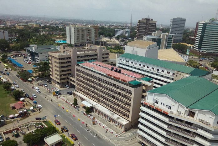
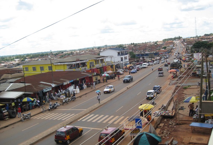
Greater Accra was formerly part of the Eastern region from 1960 until 1982 when it was carved out as an independent region under the Greater Accra Region Law implemented on July 23rd, 1982. The region’s capital is Accra (the same capital of the country) and its landmass has been given as 3,245 Km² making it the smallest region in the country. However, irrespective of its small landmass, the region is highly populated, with a current population size of over 4.1 million people.
The Greater Accra is also known for sharing common boundaries with the Eastern Region in the North, The Volta Region in the East, The Gulf of Guinea in the South, and The Central Region in the West. More so, in these regions, there are many tourist centers which include parks, recreational centers, national monuments, and historic sites, etc. It is also the most citified place in Ghana and the seat of many money-making ventures including numerous establishments owned by Ghanaians and foreign investors.
2. The Northern Region
- Regional Capital: Tamale
- Population: Over 2,479,461
- Area: 70,384 Km² (in Total)
- Key Landmark: Naa Gbewaa Palace, Buntaga Irrigation Dam
The Northern region was the largest region in Ghana with a landmass of 70,384Km² before the referendum in 2018 when the Savannah Region and the North East Region were created. Its regional capital is Tamale and it has 16 districts with a population size of over 2,479,461.
The Ghanian Northern region has close proximity to Sahel and Sahara deserts therefore it is drier than the southern regions. It shares common boundaries with the North East Region, Oti region, Savannah Region, and the Republic of Togo. However, irrespective of its dry climate, this region deals majorly in agriculture as more than 70% of the population engage in one form of agriculture or the other.
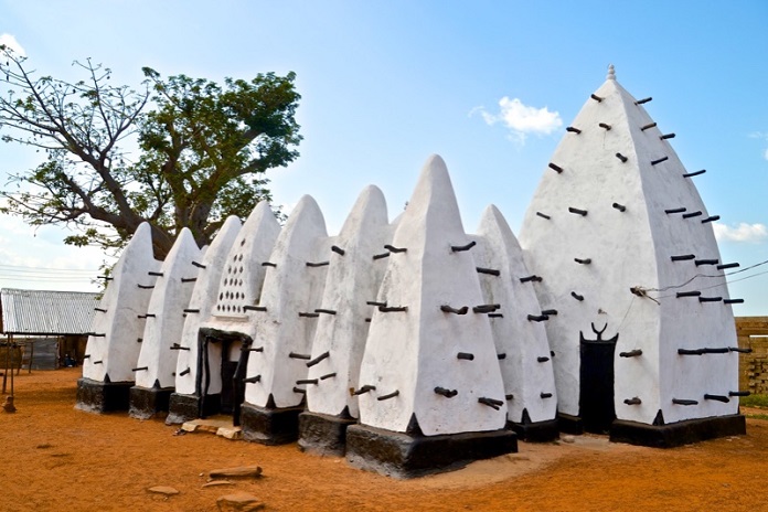
This place is also a major site for tourism and some tourist centers you can find in the Northern Region include Naa Gbewaa Palace, Yendi, Saakpoli Slaves wells, Diarre Napagaduungbanani, Naa Binbegu Boabab Tree, Yendi, Buntaga Irrigation Dam, Sabali (River Oti), and Nawuni River (White Volta), etc.
3. The Upper East Region
- Regional Capital: Bolgatanga
- Population: Over 1 million
- Area: 8,842 Km²
- Key Landmarks: Tongo Hills, Upper East Regional Museum
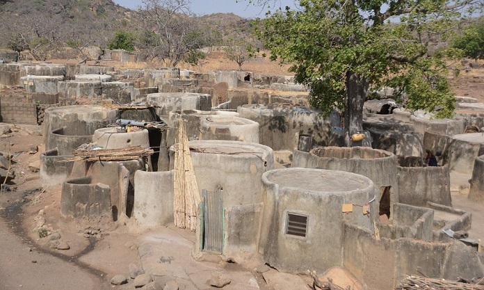
Before 1983, The Upper East Region was formally called “The Upper region”. It is reckoned as the second smallest (in size) of all the 16 regions in Ghana and despite its name, it is situated very close to the northern part of Ghana with an area of 8,842 km² and population size of 1,046,545. It is 75% rural and has 15 districts with its capital city is Bolgatanga, also called Bolga. This region also shares common boundaries with Togo and Burkina Faso.
This region is also predominantly an agrarian region with a large number of its population involved in cultivation. They are also notable for hosting several festivals to either launch a planting or harvesting season. Some of these festivals celebrated in the region include, the Fao Festival, Gologo Festival, and Damba Festival amongst several others.
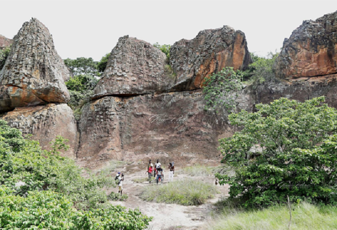
More so, the Upper East region is home to several recreational and tourist centers which include; Paga Crocodile Pond, Sombo Bat Sanctuary, Jafiiri, Sacred Royal Python Sanctuary, Tongo rocks, Bongo Rocks, Tono Dam. One can also find historic sites like Naa Gbewaa’s shrine, Navrongo’s mud-built church, and Nalerugu in this region.
4. The Upper West Region
- Regional Capital: Wa
- Population: About 868,479
- Area: 18,476 km²
- Key Landmarks: The Gwollu Wall in the Sissala District
Wa is the regional capital of The Upper West Region of Ghana as well as its largest settlement of all the 11 districts that make up that region. The area of the Upper West Region is 18,476 km² making it one of the largest regions in the country. The region has a population size of about 868,479 people whose economic activity is mainly agriculture.
This region was originally carved out from the present day Upper East region with which it shares a common boundary as well as, The Northern region, and Burkina Faso. This region is also made up of 11 districts out of which 11 are ordinary districts and 1 is a municipal district.
Like other regions of Ghana, The Upper West Region also boast several tourist attraction places some of which are; The Wechiau Hippopotamus Sanctuary and the Gwollu Wall in the Sissala District. They also celebrate several festivals to herald the beginning of the different seasons
5. The Ashanti Region
- Regional Capital: Kumasi
- Population: Over 4 million
- Area: 24,389 km²
- Key Landmarks: Bobiri Forest and Wildlife Sanctuary
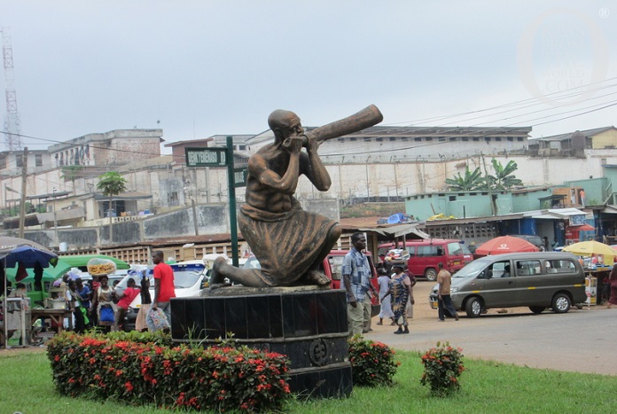
With 27 Districts and an area of 24,389 km², the Ashanti region is reportedly the 3rd largest in all the 16 regions in Ghana. It is also the most populated region with a population of about 4,780,380 people. This region which is situated in the middle belt of Ghana is notable for sharing common boundaries with several other regions which include Bono, Bono East, and Ahafo Regions in its Northern axis, Eastern region in the East, Central and Western Region on its South and South West axes respectively.
This region has also gained a lot of attention for being home to several tourist centers such as Butterfly Sanctuary, Centre for National Culture, Rattray Park, Komfo Anokye Sword site, Manhyia Palace Museum, Kumasi Fort and Military Museum, and Armed Forces Museum amongst several others. More so, their festivals like Papa Festival and Kente Festival are attended by a large number of persons both within the country and from other countries.
6. The Oti Region
- Regional Capital: Dambai
- Population: 742,664
- Area: N/A
- Key Landmarks: Lake Volta, Oti River
The Oti region of Ghana is one of the newly created regions in Ghana. It was carved out of the Northern part of the Volta region with its regional Capital as Dambai. It is made up of 9 districts with a population size of about 742,664.
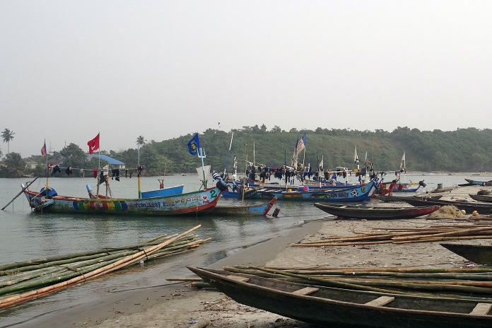
The Oti Region shares common boundaries in the North, East, South, West, and Northwest with the Northern Region, Togo, Volta Region, Bono Region, and Savannah Region respectively. It is also known that people in this region engage in activities like trading, fishing, cattle rearing, and farming.
More so, it might interest visitors to know that this region has nice tourist centers which are; Kyabobo National Park, Lake Volta, Breast Mountain, Chilinga Chaiso Forest Reserve, Hanging VillaShared, Shiare, and several others.
7. Volta Region
- Regional Capital: Ho
- Population: Over 2 million
- Area: 20,570 Km²
- Key Landmarks: Volta River, Mount Adfaja
The Volta region has 25 districts with Ho as its capital city. It ranks among the largest regions in Ghana with a land area of 20,570 Km² and a population size of about 2,118,252 made up of people who are of different tribes and languages. The largest ethnic group is Ewe, others include the Guan, and the Akan people.
Apart from the Volta River, and the museum, Volta Region is also known for being the home to numerous mountains. Some of the notable mountains that can be found in this region include Mount Afadja, Mount Adaklu, and Mount Gemi. Other tourist attractions the Volta region provides are Tafi Agome Caves, Tafi Atome Monkey Sanctuary, Wli Waterfalls, and Tagbo Falls.
8. The Bono East Region
- Regional Capital: Techiman
- Population: Over 1 million
- Area: 22,952 km²
- Key Landmarks: Bono Manso slave market, Kristo Boase Monastery
The Bono East region is one of the new regions carved out of the Brong Ahafo region. It has 11 districts with its capital as Techiman. The Bono East region is also quite massive with a size of 22,952 km² and it is home to more than a million people who are notable for fish farming, yam planting, and other agricultural activities.
This new region is not also left out when it comes to having important places as the region has several interesting places tourists will fancy. Some of these places are Buoyem Caves and bats colony, Kintampo waterfalls, Kristo Boase Monastery, Tano River, Nchiraa waterfalls, Forikrom Boten Caves, and shrines, Tanoboase Sacred Grove and Shrine, Digya National Park, and Fuller Falls amongst others.
9. The Ahafo Region
- Regional Capital: Goaso
- Population: About 599,852
- Area: 5,193 Km²
- Key Landmarks: Tano river
This is also one of the new regions carved out of the south-eastern part of the Brong Ahafo Region in 2018, and since it became a region, it adopted Goaso as its capital city. It has a sizable population of less than a million persons living within a land area of 5,193 Km².
The Ahafo region is made up of 6 districts which are Tano South Municipality, Tano North Municipality, Asunafo North, Asunafo South, Asutifi North, and Asutifi South. As of now, the notable place of this region is the Tano River.
10. The North East Region
- Regional Capital: Nalerigu
- Population: About 588,800
- Area: 9,072 Km²
- Key Landmarks: White and Red Volta Rivers
This region was also broken out from the then Northern region in 2018. It is situated in the northern part of Ghana with its capital city as Nalerigu. The North East region also has a sizeable population of less than a million persons with 85% of them actively involved in Agriculture.
With regards to its structure, this region comprises a total of 6 districts which are; East Mamprusi Municipality, West Mamprusi Municipality, Bunkpurugu-Nyakpanduri, Yunyoo-Nasuan Mamprugu Moagduri, and Chereponi District Assemblies. More so, it’s worth knowing that the Nayiri is the ruler of this entire region and his paramountcy goes beyond the boundaries of this region to the national level as well.
The region is also home to notable places like Gambaga Escarpment, White Volta and Red Volta Rivers, Ancient rock art at Gingana, Kpatiritinga, Jilik, and Tusugu, the NaYiri Palace in Nalerigu, NaJeringa historic slave wall in Nalerigu, Gravesites of ancient Mamprusi and Mossi kings in Gambaga and others.
11. Savannah Region
- Regional Capital: Damongo
- Population: More than 500,000
- Area: 35,862 km²
- Key Landmark: Larabanga Mosque
It is quite surprising that the Savannah region, though one of the new regions created in 2018, is the largest in size with an area of 35,862 km². However, with regards to its population, the region has a low population density comprised of about 581,368 people when compared to other regions with large landmass.
This region is divided into 6 which include Bole, North Gonja, Sawla-Tuna-Kalba, West Gonja, East Gonja Municipality, and The Central Gonja. As of now, its capital city is Damongo.
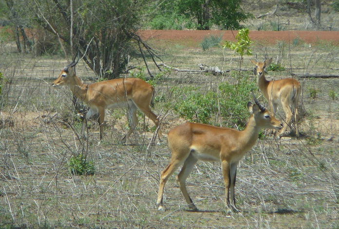
There are also very interesting tourist centers in the Savannah region that attracts a lot of visitors around the world. Some of these tourist centers include; Mole National Park, Bui National Park, Larabanga Historic Mosque, and Wechiau Hippo Sanctuary.
12. Western North Region
- Regional Capital: Wiawso
- Population: Over 900,000
- Area: 2,391Km²
- Key Landmarks: Ankobra River
The Western North region is again one of the newly created regions in Ghana. It has 9 districts, a population size of about 928,309, and covers a landmass of 2,391Km². The capital of this region is Wiawso and the major languages spoken by the inhabitants are Sefwi, Akan, French, and English.
The inhabitants of this region are largely fish farmers as well as crop farmers because of the climate of the region which is characterized by heavy rainfall accounts for widespread farming activity in the region. There are also several gold mines in this region that are mined by both large and small-scale companies located in the area. More so, the region is notable for its forest reserves which serve as a major tourist attraction site.
13. The Western Region
- Regional Capital: Sekondi-Takoradi
- Population: Over 3 million
- Area: 23,921 km²
- Key Landmark: Ankroba River, Nzulezo Village
With regards to its location, the Western region is situated in the Southern part of Ghana, with boundaries stretching towards Ivory Coast. It has a land area of 23,921 km² and a population size of 3,093,201.
Unlike many other regions, the Western Region is not just known for a particular economic activity. They deal in agriculture due to the high rate of rainfall which accounts for the soil’s fertility in that area. There are also several gold mines in the region as well as offshore drilling rigs.
Other features that make the region popular are the fact that several rivers flow through it including the Ankobra River, the Bia River, the Pra River, and part of the Tano River. More so, the popular village, Nzulezo which was nominated as a UNESCO World Heritage Site can be found in the Western Region and this has attracted a lot of tourists to the area.
14. Eastern Region
- Regional Capital: Koforidua
- Population: Over 2 million
- Area: 19,323 km²
- Key Landmarks: Akosombo dam, lake Volta, Umbrella Rock, Akaa Waterfalls
With its capital as Koforidua, the Eastern region of Ghana is relatively a large region and it is notable for having the highest number of districts that are 33 districts as of 2018. More so, the region’s GDP is largely dependent on the Electricity generation at the Akosombo dam. Which makes this region distinct from other regions in Ghana that are largely agrarian.
The Eastern Region is also home to several important places which serve as tourist attraction sites and they include; Dodi Island, Aburi Botanical Garden, Akosombo Dam, Shai Hills Resource Reserve, and Tetteh Quarshie Cocoa Farm amongst others.
15. Central Region
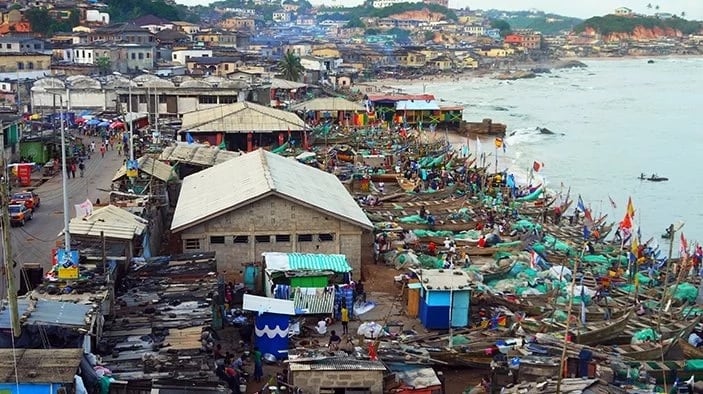
- Regional Capital: Cape Coast
- Population: Over 2 million
- Area: 9,826 km²
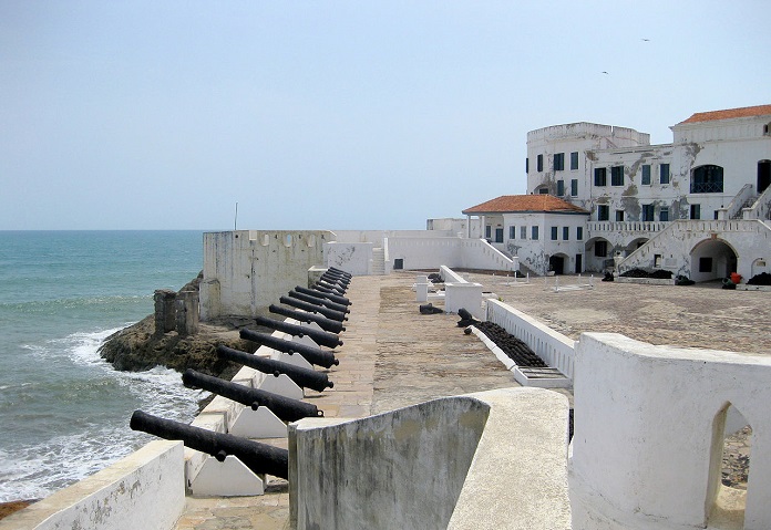
- Key Landmark: Coast of Winneba, Cape Coast Castle, Elmina Castle
The Central Region which has its capital as Cape Coast covers an area of 9,826 km² and has a population size of about 2,201,863. As of now, it has 20 districts and shares common boundaries with Ashanti, Eastern, Western, and Greater Accra Regions of Ghana as well as the Gulf of Guinea.
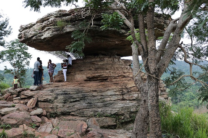
You will not be wrong to call this region the educational, industrial, and major tourist center of Ghana as it is notable for having prestigious educational centers, industries, and 2 remarkable UNESCO World Heritage Sites – Cape Coast Castle and Elmina Castle where visitors pitch their tents on visits.
Other recreational and tourist centers include Kakum National Park, International Stingless Bee Centre, Monkey Forest Resort, and Assin Manso Ancestral Slave River Park, amongst others.
16. The Bono Region
- Regional Capital: Sunyani
- Population: Over 1 million
- Area: 11,481 km²
- Key Landmark: Bui National Park, Bui Dam
The Bono Region came into existence after the creation of the Ahafo Region and the Bono East Region from the former, Brong- Ahafo region. It has an area of 11,481 km² and a population size of 1,082,520 people. Its regional capital, Sunyani is popularly known as the Green City and it once won the title as the neatest city in Ghana.
As of now, there are 12 administrative districts in this region and they all have several tourist centers. Some of which are the Bui National Park, the Bui Dam, the Duasidan Monkey Sanctuary.
Recap Of The New Regions In Ghana?
The creation of more regions in Ghana had been a long-standing course until 27th December 2018 when a referendum on region creation was signed and voting was done across the 47 districts that would be part of the new regions. After this was done, a total of six regions was created and they are:
1. The Savannah Region carved out from the Northern Region
2. The North East region, also from the Northern region
2. The Oti Region which was carved out from The Volta Region
4. The Western North carved out from the Western Region
5. Ahafo which was carved out from the Brong-Ahafo Region
6. Bono East which was also carved out from the Brong-Ahafo Region
Is The Largest Region The Richest?
Ghana has become one of the fastest-growing countries in West Africa especially recently that foreign companies like Twitter have established their African headquarters there. It is recognized as one of the most peaceful countries with little or no insurgencies or insecurities like it is found in some other West African countries.
Prior to the creation of the 6 new regions, the Northern Region was the largest in size with an area of 70,765 km² but on the creation of the new regions; Savannah has become the new largest region covering an area of 35,862 km². Savannah as we know was also carved out from the former Northern Region, thus it is no wonder that it is a new largest region however, this does not make it the richest region.
On the other hand, the richest region in Ghana is the smallest region in terms of landmass and this is the Greater Accra Region. This is a result of the numerous economic activities that go on in the region. Following closely is Sekondi-Takoradi in the Western region given by the oil newly discovered in the area.
Which Region Has The Highest Population In Ghana?
According to the census carried out in 2010 and the 2018 population projection, the region with the highest population is the Ashanti Region. It has a population size of about 4,780,380.
Which Region Is The Most Visited Region In Ghana?
The most visited region in Ghana is the Ashanti Region given the fact that they have more beautiful places that attract tourists. The only natural lake in the country, Lake Bosomtwe is located in Kumasi, the capital city of the Ashanti Region. This beautiful lake is surrounded by mountains and has different species of fishes in it.
More so, this region is home to several other historical sites and recreational centers that are breathtaking. There are also several other notable festivals celebrated in this region which has gained popularity beyond the borders of the Ashanti region hence attracting troops of tourists to the area.